By Bob Aston
The dwindling water volume from the
water sources around Sipili sub catchment area has been prevalent for a long
time now. This is exacerbated by encroachment of the catchment area hence
general decrease in vegetation as a result of human activities.
Previously, little effort had been
made to protect water quality in the sub catchment. Most of the resources in
the sub catchment are not protected hence deterioration both in quality and
quantity.
Sipili area is composed of two sub
catchments. One system starts from Lariak Forest and is composed of about six
dams that drains in Mukutani River whose mouth is Lake Baringo. The other
system starts from Mlima Senge and is composed of about four dams draining into
North Aiyam which later drains into Ewaso Narok.
Sipili sub catchment is partly within
the Ewaso Narok management unit of the sub region and has been categorized by Water
Resources Management Authority (WRMA) as ALARM. The sub catchment is in the 5AC
hydrological unit and is situated within the Engare Narok Melghis Sub-region
office within the Ewaso Ngiro North Catchment Area (ENNCA) region.
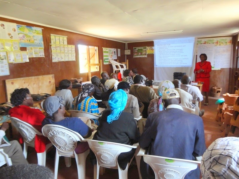 |
| WRMA addressing Sipili WRUA members |
The water resources problems
identified in the sub catchment include; Water scarcity, catchment destruction,
water pollution, water conflicts, poor drainage, soil erosion and illegal
abstraction.
Some of the most common causes of
poor water quality in the sub catchment are siltation, direct watering from
springs, dams and streams by people and livestock, poor cultivation methods and
poor or no disposal methods of insecticides and cleaning of horticultural
equipment.
The sub catchment has no permanent
rivers and the main water sources are springs, shallow wells, streams,
boreholes and dams. Ground water is the predominant source of abstractions. The
sub catchment has only five boreholes and eleven shallow wells that are mostly
dug next to the dams and fitted with hand pumps.
The sub catchment also has eleven
(11) dams and one (1) water pan. This includes; Karungubii, Wangwachi A,
Wangwachi B, Kauka, Ndaragwiti, Ndemu Ndune, Muraya, Dimcom, Marura, Kahura,
Mwireri and Mwireri B dam. The area also has two springs namely Kiriko and
Kagwaru and a water pan called Leleshwa.
Various stakeholders in the region
have already started taking some measures in order to conserve the sub
catchment. This includes; surveys and conservation of riparian and degraded
areas, carrying out erosion and sediment surveys, mobilizing and sensitizing
the community on the significance of the environment, establishing soil and
water conservation plans, putting up soil erosion structures as well as
planning to plant 100,000 indigenous trees.
Monitoring on water resources in
terms of availability, quality, usage and pollution has never been done by any
organization in the sub catchment.
In order to preserve water resources
in the sub catchment, stakeholders have now started working on a water
allocation plan (WAP). The stakeholders are also planning to come up with
Effluent Discharge and Control Plans (EDCP) in order to reduce pollution. This
will also compliment the enforcement of Environmental Impact Assessment (EIA)
on all organizations and water abstractors before they commence any activity in
the area.
The water stakeholders have also
agreed on the need of ensuring regular monitoring of water resources and
communication of the status of the catchment as well as the production of
monthly returns.
Through support from Tree Is Life
Trust (TILT), Sipili Water Resource Users Association (WRUA) in collaboration
with WRMA, Arid Lands Information Network (ALIN), Ministry of Agriculture,
Livestock and Fisheries, United Trust and local national government officials
(chiefs) has come up with a Sub Catchment Management Plan (SCMP).
Sipili WRUA will use the SCMP as a
basis for undertaking intervention and catchment protection in the region aimed
at protecting the natural resources and above all improving the lives of the
communities along the water catchment.
The SCMP will also promote the
already existing natural resources, enhance livelihoods and climate resilient
groups within the Sub Catchment. The SCMP covers a period of five years from
January 2015 to December 2020.
No comments:
Post a Comment